Первый Байкальский


Baikal is preparing for the winter... This means that the famous ice crossing will operate there soon. We decided to find out why Baikal ice is dangerous and when people first began to use it as a full-fledged road...
About 350 years ago, a diplomat, a scientist, and a geographer Nikolai Spathari who moved to winter Baikal wrote: “The ice thickness makes up a Russian fathom (in the 17th century, one Russian fathom was equal to 2.16 meters) and even more, due to this fact people sometimes travel along ice surface on sledges and sleds in winter, however, this is pretty scary <...> there are cracks up to three or more fathoms wide, and the water therein does not spill on ice and is soon covered with ice once again with loud noise and thunder, and a kind of an icy shaft appears in that place”.
Centuries have passed since that journey; but nothing will probably change even after a dozen centuries! Beautiful, economically important, but deadly dangerous ice roads will continue to attract people due to the lack of other alternatives, even if a person sees the ice torn apart by a mysterious force with his/her own eyes, at his or her very feet or under the wheels of a car, and notices a terrible abyss of black freezing water opening ahead...


We know a lot of things about the history of navigation on Lake Baikal. Various kinds of boats could be seen on its waters: rafts, longboats, steamboats, icebreakers... But each year the frozen lake brought up another transport option - ice. The process can be represented quite simply. When the air temperature drops below –20 ° C, ice thickness grows by 4-5 cm every day, which lasts for 3-4 days. In general, ice layer thickness in the area of the lake reaches from 70 to 113 cm. It is believed that an ice layer of 50 cm can carry 15 tons, and a layer of about a meter withstands the weight of a helicopter or a steam train.
Travelers prefer Baikal ice roads in early spring, when gusty wind carries away all the snow, immaculately polishes the ice, making it mirror-transparent. The largest number of trips on the frozen lake surface falls to the period from late February to early April.
However, already at the end of March, the sun on Lake Baikal warms up the air in a rather intense manner. Although this does seriously affect the bulk of the ice, you should not approach the rocks at this time. Thaw holes are formed there much more quickly.
By the way, experts have revealed several regularities. First, the larger the amount of snow, the thinner the ice. Secondly, if there is a lot of snow, but it melts quickly, the ice is less reliable and less homogeneous than the ice without any snow on it. This happens due to the active absorption of melting water, which transforms the structure of ice. Thirdly, the ice that is broken by a storm during the lake freezing is less durable than homogeneous and monolithic one.
It is no coincidence that such traffic on Lake Baikal is so heavy during the cold season. The lake allows people to travel along the surface of its southern coast during more than 100 days a year and on its northern coast - during about 130 days a year. Indeed, this opportunity was successfully used by Siberian Cossack explorers. There are historical testimonies that prove that the service people of Vasily Kolesnikov (1646) found themselves on the bare ice of Lake Baikal with only sleds at hand, so they guessed to use the strongest Baikal wind blowing in their back. They simply fixed sails on the sleds.
The importance of winter roads grew especially high in the 17th century, which was clearly connected with the expansion of trade with China. They believed that there was simply no better way to deliver precious skins, on the one hand, and silk and tea, on the other hand.
Moreover, the scale of the transportation of goods through Lake Baikal grew beyond measure, when the Russian Empire and then the Soviet Union started the economic development of the territories of Siberia and the Far East. This involved the construction of the Circum-Baikal Railway within the framework of construction of the Trans-Siberian Railway; the railway was put on the ice, parallel to the horse road, in the beginning of the Russo-Japanese War, and, finally, the attempt to find the northern route along Lake Baikal in connection with the planning of the Baikal-Amur Railway, which was interrupted by the Great Patriotic War
The search for the most successful options for laying the Baikal-Amur Railway was resumed immediately after the end of war. A specific task was set: to carry a large amount of cargo on the Baikal ice along the route Irkutsk - Bayandai - Elantsy - Kulara - Nizhneangarsk.
There was no such experience before! A whole car convoy was to drive on the Baikal winter road for the first time! It was unknown how the ice would endure this, how to quickly detect and terrible cracks and overcome them... But the first trip was organized and proved that it was possible to cope with the problems of snowy roads. This was fully demonstrated by the construction of the bigger Baikal-Amur Railway, where a huge amount of cargo was transported on winter roads along the line Ust-Barguzin-Nizhneangarsk from the beginning of 1970s until the very launch of the railway.
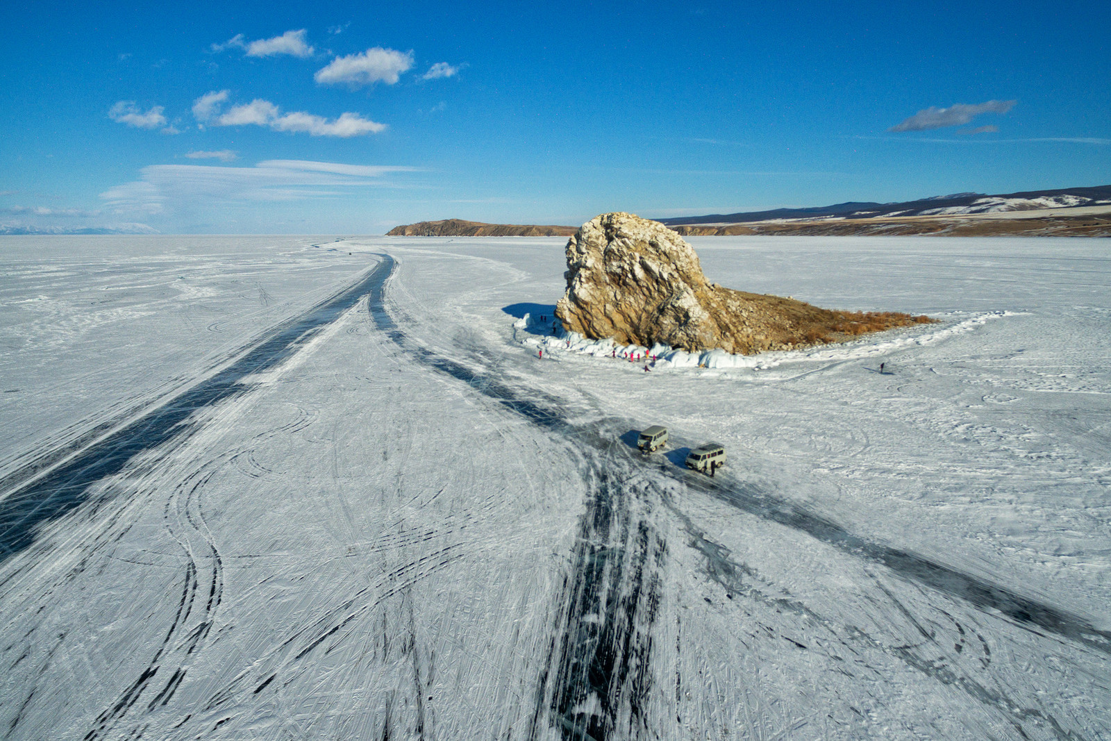
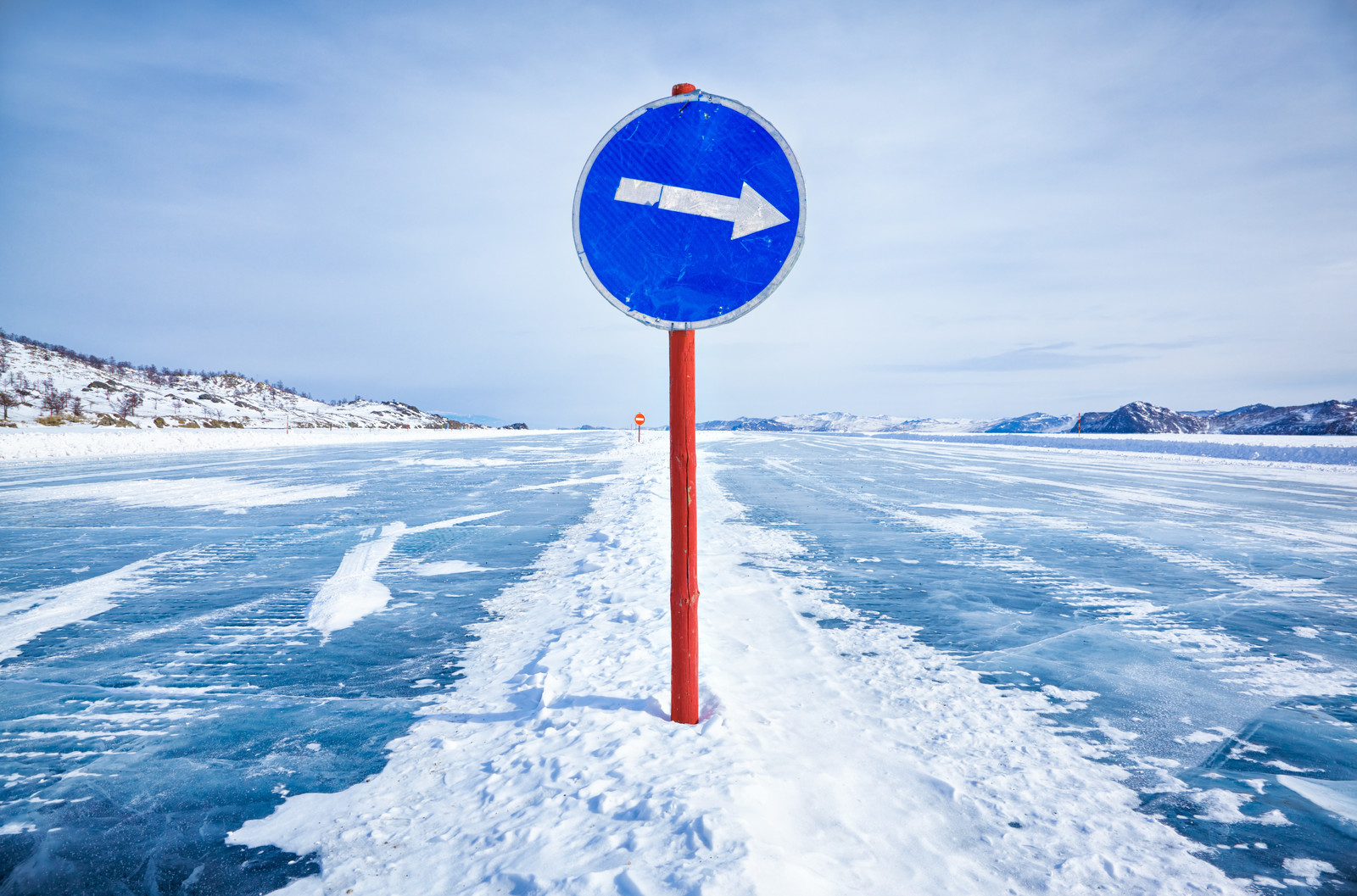
Today, the officially recognized ice road on Lake Baikal constantly monitored by the Ministry of Emergencies and road services, equipped with signs, milestones, and special turnoffs to the ice, is the crossing Kurkut - Olkhon connecting the island with the mainland.
Accordingly, the remaining winter roads can be formally considered unauthorized, but what would people do without them? Remote places of specially protected natural areas, weather stations, wintering places, tourist centers require the delivery of a great number of necessities. The popularity of Lake Baikal and winter recreation on it contributed to regular trophies, rallies, expeditions, ATV tours held on the ice...
It is believed that the most active traffic is observed in the area of Maloe More Strait, Barguzinsky and Chivyrkuisky bays, as well as within the “square” Severobaykalsk - Kotelnikovsky Cape - Khakusy-Ayaya - Nizhneangarsk.
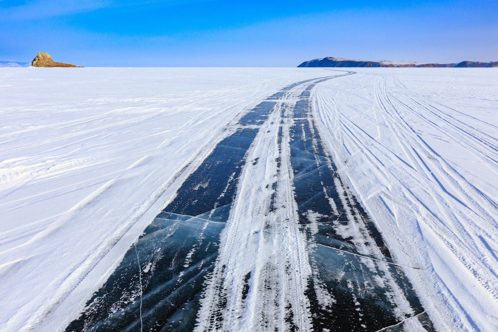
At the same time, one should always remember that a transparent Baikal road is not only a magical beauty, but also a horrible danger!
One example of this is presented by the infamous cracks that are called “extension joints” by the scientists. Unfortunately, they can be found anywhere on the lake; as a rule, they arise in the same place time after time, reaching a length of up to 10-40 km and a width of up to 4 m. From the scientific point of view, the appearance of such pits is caused by linear expansion or contraction of ice upon daily temperature drops that sometimes reach 20-30 ° C.
There also exist open thawing holes covered with thin ice, hummocks, as well as ice overthrusts...
All this is dangerous not only for cars falling under water even on traditional winter roads, but also for skiers, cyclists, snowmobile and ATV travelers, hikers...
One must always remember: no matter how reliable the ice may seem, it is difficult to predict how treacherous Lake Baikal can be!

Academician Okladnikov believed that the name of the Kika River (with the emphasis on the second syllable) was derived from the Turkic “green river”. This is the name of one of 336 rivers flowing into Lake Baikal.

Why should one remember about an ordinary hare - the animal with the nickname “squint-eye” that is considered a coward?

A specially protected natural monument of regional significance – “Anglichanka” Rock – is situat-ed in Selenginsky district of Buryatia. Now it is known as an observation deck with a picturesque view of the Selenga and Spassky Cathedral dated by the 18th century. However, in 1818-1841, Protestant preachers lived here. Key to Baikal explored how the life of the missionaries was con-nected with the rock, what kind of girl was wandering around it and what the London missionary society had to do with it.

The name of the valley originated from local “Bargut” which means “outskirts, wilderness”. It was a name of Mongolian tribe that used to inhabit the valley.
