Первый Байкальский


The Kichera River originates on the slopes of the Verkhneangarsky ridge and stretches for about 135 kilometers until it falls into Baikal.
The famous “Drawing Book of Siberia” written by S.U. Remezov calls the river by a different name: Icherga. There is an opinion that this name is directly connected with the Tungus (Evenki) word “icheri” translated as “shaman”, “forecast”, “bewitch”.
However, the situation around the modern name of the river is not so unambiguous. Some authors believe that the basis of the name undoubtedly is the Evenki toponymy, but they disagree about the original term. Some stated that Kichera was derived from the word “kichera,” meaning “rowanberry”. Others insisted that the root was different - “kocho”: “a bend of the river”, “a tortuous river”.
A famous Irkutsk scientist, ethnographer, toponymist S.А. Gurulev stressed the fact that the name of the river was an example of purely Slavic rethinking based on consonance with the Evenki name. South Slavic and West Slavic languages have the root basis “Kichera”, “Kusega” for designating mountain terms. For example, the Ukrainian word “Kichera” is translated as “a mountain covered with forest, except for the summit”, or “a steep mountain covered with forest”, or “the top of a mountain”.
The Kichera River flows through Severobaikalsky district of Buryatia: the river’s water catchment area occupies about 2,430 sq. km. It can rightly be called the friend of Verkhnyaya Angara.
First, Kichera unites with its “friend” - the 14-kilometer Angarakan channel close to its mouth (at a distance of approximately 16–18 km); below this point the river is divided into three channels. Secondly, when the river enters Baikal, it creates a delta and the unique Angarsky Sor Bay - jointly with Verkhnyaya Angara.
Kichera is fed by a fairly large number of small tributaries, the largest of them is considered to be the Kholodnaya River (about 85 km long).
The most interesting feature of Kichera is the fact that there are many lakes along its course, some of them are crossed by the river: Bludnoye, Verkhnee Kicherskoe Bolshoye (“Big Upper Kichera Lake”), Verkhnee Kicherskoe Maloye (“Small Upper Kichera Lake”), Kulinda (derived from the Evenkia “kulinda” meaning “a snake”).
If you look at Kichera from a helicopter’s perspective, you can clearly see that the riverbed is a system of loop-like bends created by nature. The character of the riverbed is so diverse that the river can be easily divided into several parts.
The first section is the source of Kichera located at an altitude of 1265 meters on the territory of the Verkhneangarsky ridge located in the northern Baikal region. The length of this section makes up about 10–15 km; it can be described as a standard mountain river with a rocky bottom, flowing through a narrow U-shaped valley surrounded by steep slopes of the bald mountains. Here Kichera is replenished by several tributaries and flows into Kulinda Lake.
The second section can be called “lake part”. Its length is about 20 km, and Kichera passes through a series of large lakes in this place.
The next section is the middle one, its boundary begins from the Vtoroye Verkhneye Kicherskoe Lake (“Second Upper Kichera Lake”) and ends at the point called Pristan: the height difference between the two points makes up more than 100 meters. And although the valley of Kichera begins to expand, the mountains do not disappear, still “embracing” it. Probably, this section explains why some specialists start defining the name as derived from the Evenk “kocho” – “a tortuous river”. This section of Kichera strongly resembles a winding snake. Large rapids and forest obstructions intersperse with calm flow of water, and the bottom surface is also unstable: it can be covered with pebbles or large boulders in different places.
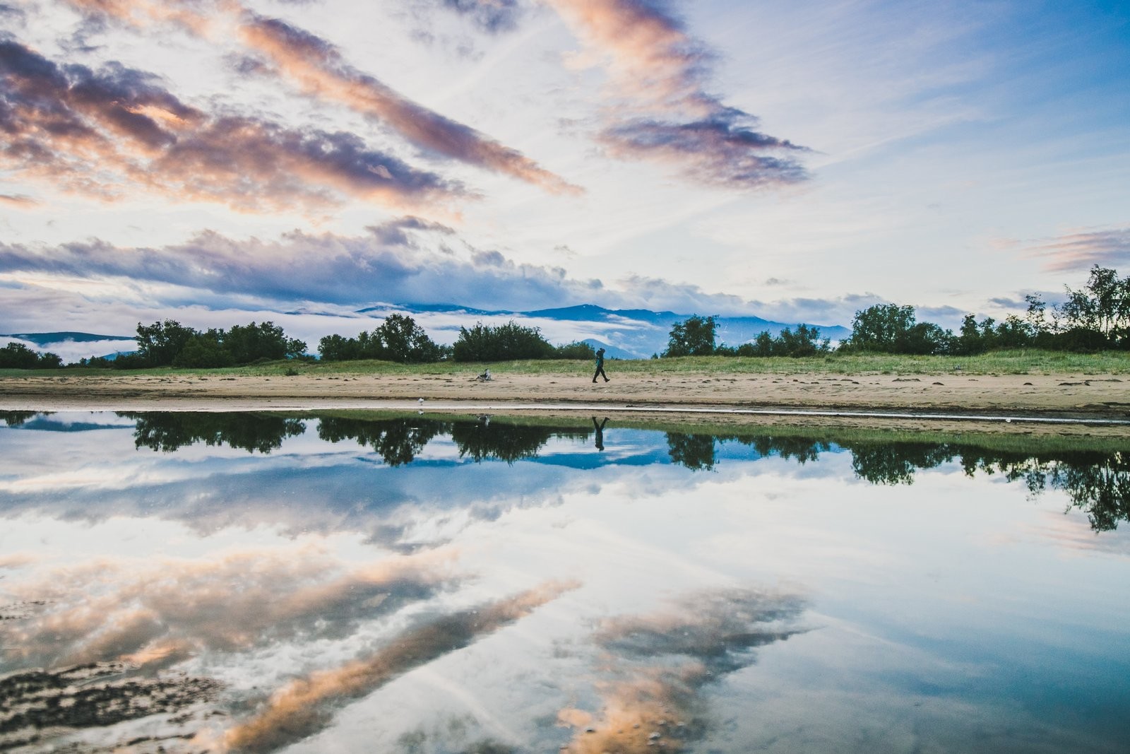
Finally, the last lower part ends in confluence with Baikal. It stretches for about 40 km, and here Kichera has a completely different, calm character. Its valley expands and merges with the marshy lowland, in the place where the delta of Verkhnyaya Angara is located.
The deltas of the rivers of Kichera and Verkhnyaya Angara create a special natural object - the Angarsky Sor Bay, which is also called Verkhne-Angarsky or Severo-Baikalsky.


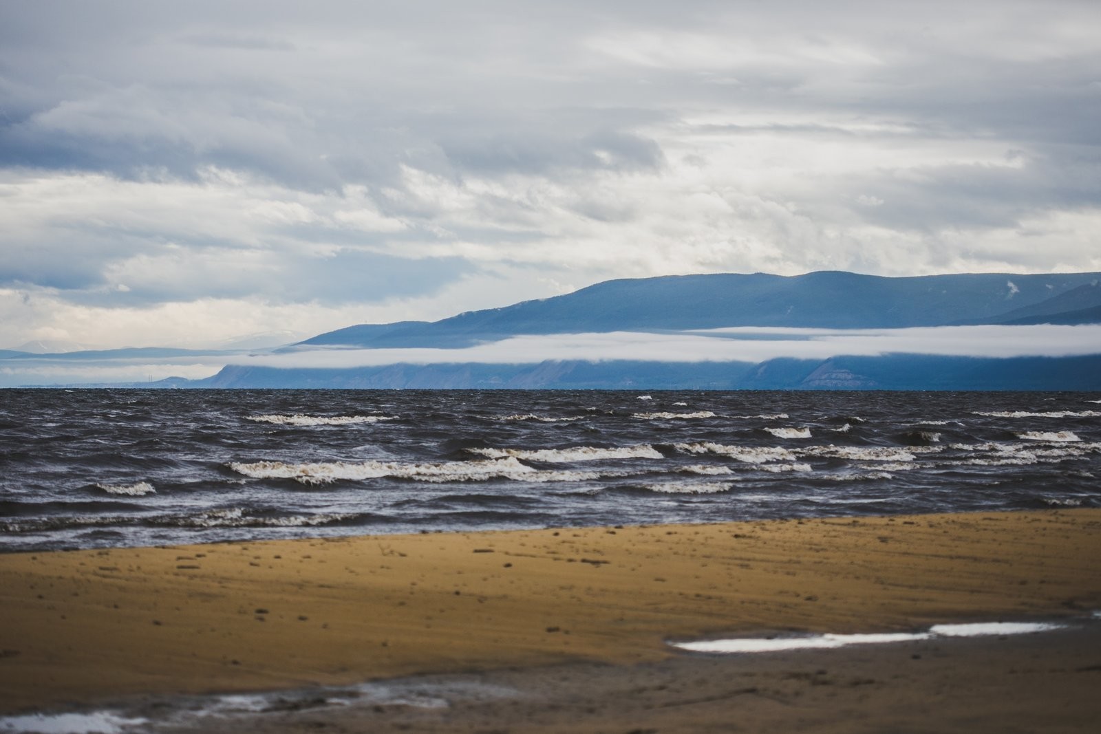
This water reservoir is a state natural biological reserve fenced off from Baikal by a 17-kilometer line of islands and sands of the Yarki Island.
The origin of this shallow bay is not completely clear, but there was an opinion that its origin was similar to Proval Bay, that is, it is the result of the seismic the activity of the Baikal nature.
The bay is a semi-closed water reservoir with its own specific ecosystem, different from Baikal. Its size after the construction of an HPP in Irkutsk and the increase in the level of Baikal water has undoubtedly grown; but a serious danger arose: there is a possibility of erosion of the Yarki island strip, flooding, and destruction of the peat bog islands (areas of non-sinking bog turf with powerful rhizomes). The damage done to them can greatly violate the natural conditions of the water reservoir, and we cannot just let it happen. After all, this place is a traditional habitat and breeding place of numerous species of fish and birds.
The water contains a huge amount of attractive food for these living creatures and water temperature can rise up to +24 degrees Celsius.
Therefore, the bay and the entire delta are extremely comfortable for living and feeding of various types of fish: taimen, black grayling, lenok, whitefish, perch, pike, burbot... But this the territory is especially important for the preservation of the Baikal cisco (omul) population. The fact is that the mouth of Kichera, as well as of other rivers flowing into Northern part of Baikal, as well as the Angarsky Sor, is a place on the spawning route of the Baikal cisco and downstream migration of its fry.
The bay is protected by the state not only for the purpose of saving the birds constantly living on this territory. It is also a transit route for the birds traveling to spend winter in the East and Southeast Asia, the Indian subcontinent, the Caspian Sea. They stay in the delta for different periods of time. Some birds, for example, waterfowl, remain there for a long period. Other birds are just “transit passengers”.

Academician Okladnikov believed that the name of the Kika River (with the emphasis on the second syllable) was derived from the Turkic “green river”. This is the name of one of 336 rivers flowing into Lake Baikal.

Why should one remember about an ordinary hare - the animal with the nickname “squint-eye” that is considered a coward?

A specially protected natural monument of regional significance – “Anglichanka” Rock – is situat-ed in Selenginsky district of Buryatia. Now it is known as an observation deck with a picturesque view of the Selenga and Spassky Cathedral dated by the 18th century. However, in 1818-1841, Protestant preachers lived here. Key to Baikal explored how the life of the missionaries was con-nected with the rock, what kind of girl was wandering around it and what the London missionary society had to do with it.

The name of the valley originated from local “Bargut” which means “outskirts, wilderness”. It was a name of Mongolian tribe that used to inhabit the valley.
